Webcams
 Live info
 Ski passes
 Useful information
 Retour
randonnee
Retour
randonnee
Walking itinerary - Col de l'Aulp Couti from Bassachaux
A hike that takes you to the Col de l'Aup Couti with a view of Lac de Montriond, then on to the Chalets de Lens.
Description
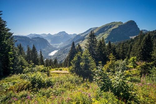
From the Col de Bassachaux (1777 m), a listed Geopark, you'll head for the Col de l'Aup Couti on an easy, fairly level path. From here, you can admire the view over the Aulps valley and Lac de Montriond.
You will then reach the foot of the Pointe de Chavache (1812 m). Here you can meet flocks of sheep. The winding path becomes steeper to reach the Col de l'Aup Couti.
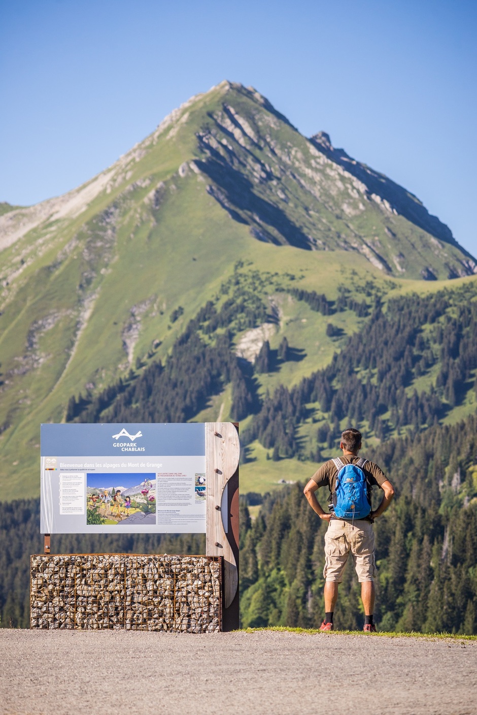
At Col de l'Aup Couti, you can admire Mont de Grange and the cliffs of Pointe d'Ardens. You then descend to the Chalets de Lens mountain pasture.
Then back up to the Col de Bassachaux via part of the GR5, which crosses the Abondance valley.
A great hike to enjoy the mountain scenery in a wild valley setting.
Additional information
Whichever walk you choose, we recommend that you :
- Wear appropriate footwear and always take with you: warm clothing, preferably waterproof, plenty of water, sunglasses, sun cream and a small first-aid kit.
- Do not set off alone.
- Inform someone living in the valley of your plans.
- Do not change the planned itinerary indiscriminately. But do not hesitate to shorten it if necessary.
- Carry a map and even a torch.
- Check the weather forecast before setting off.
- In the event of a thunderstorm, move away from ridges, passes and summits as soon as possible and never take shelter under an isolated tree.
-
Minimum age : 16 years
Animals
Pets allowed : Yes
Pets accepted on a leash only.
Prices
Free access.
Route
-
 Distance
5.8km
Distance
5.8km
-
 Type of itinerary
Loop
Type of itinerary
Loop
-
 Elevation gain
370m
Elevation gain
370m
-
 Negative elevation
370m
Negative elevation
370m
-
 Daily duration
02h20
Daily duration
02h20
-
 Marked itinerary
Yes
Marked itinerary
Yes
-
 Details about signage
Departmental signposting on a beige metal plate with green lettering.
Details about signage
Departmental signposting on a beige metal plate with green lettering.
-
Tricky sections
The return is via a steep passage (secured by a chain).
-
 Types of terrain
Stone,
Ground,
Grit,
Not suitable for strollers
Types of terrain
Stone,
Ground,
Grit,
Not suitable for strollers
-
 Average altitude
1800m
Average altitude
1800m
-
 Maximum altitude
1812m
Maximum altitude
1812m
Opening period
From 01/06 to 30/09.
Accessible except during snow and depending on weather conditions.
Please check with the Tourist Office for the latest information on access conditions. This route is usually suitable for strong walkers during spring, summer, and autumn, except in adverse weather.
Subject to favorable weather.
Adaptive tourism
-
 Not accessible in a wheelchair
Environments
-
Lake view
-
Mountain view
-
Mountain location
-
Panoramic view


-
Distance
5.8km
-
Daily duration
02h20
-
Elevation gain
370m
-
Negative elevation
370m