 Webcams
 Live info
 Ski passes
 Useful information
 Retour
randonnee
Retour
randonnee
Walking route - Boucle de la Pointe du Midi
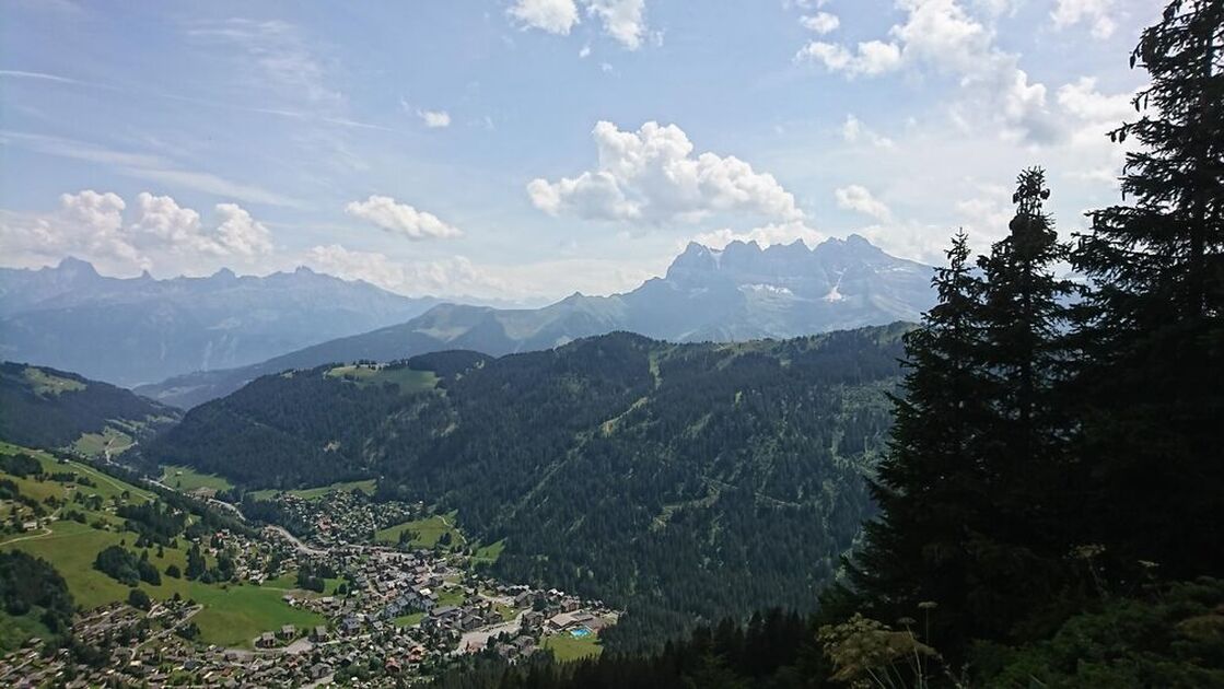
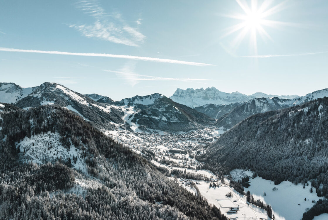
During this walk you will cross mountain pastures and forests to reach Pointe du Midi, which offers you a magnificent panoramic view of the Valley and neighbouring Switzerland. Maybe you will see chamois there.
Description
From the Linga carpark follow the direction of Aity d'en Haut. Follow the track on your left entering a beautiful spruce forest.
At the Pertuis d'en Bas mountain pasture, the trail becomes a path and leads to the Pertuis d'en Haut mountain pasture, where you can see the chalet.
At the chalet, continue the ascent on your left until you reach the Col de Fécon, which can be perceived in the middle of the "voraches", the local name given to the wild alder.
The itinerary then becomes rougher and it is not uncommon to be able to observe deer and chamois, if you're discrete. Cross over the ridges and pass by the Plan des Mitres and the Pointe du Midi to admire the picturesque and beautiful view over the Abondance valley, Morgins and the Swiss Alps.
Once at the Pointe du Midi, turn left onto the path through the undergrowth without leaving it until you reach the place called "Les Blattes". At this level, turn left to reach the Aity d'en Haut where you find the original route.
Additional information
Whichever walk you choose, we recommend that you :
- Wear appropriate footwear and always take with you: warm clothing, preferably waterproof, plenty of water, sunglasses, sun cream and a small first-aid kit.
- Do not set off alone.
- Inform someone living in the valley of your plans.
- Do not change the planned itinerary indiscriminately. But do not hesitate to shorten it if necessary.
- Carry a map and even a torch.
- Check the weather forecast before setting off.
- In the event of a thunderstorm, move away from ridges, passes and summits as soon as possible and never take shelter under an isolated tree.
-
Minimum age : 8 years
Animals
Pets allowed : Yes
Dogs must be kept on a lead due to the presence of herds.
Prices
Free access.
Route
-
 Distance
8.6km
Distance
8.6km
-
 Type of itinerary
Loop
Type of itinerary
Loop
-
 Elevation gain
788m
Elevation gain
788m
-
 Negative elevation
790m
Negative elevation
790m
-
 Daily duration
04h00
Daily duration
04h00
-
 Marked itinerary
Yes
Marked itinerary
Yes
-
 Details about signage
Departmental markings called P.D.I.P.R. on beige metal panels with green lettering.
Details about signage
Departmental markings called P.D.I.P.R. on beige metal panels with green lettering.
-
Tricky sections
Some steep and aerial passages
-
 Types of terrain
Stone,
Ground,
Not suitable for strollers
Types of terrain
Stone,
Ground,
Not suitable for strollers
-
 Maximum altitude
1892m
Maximum altitude
1892m
Opening period
From 01/06 to 31/10 daily.
Accessible outside of snowy periods and depending on weather conditions. Please check with the Tourist Office in advance to find out the current access conditions. Recommended period for use: spring, summer, and autumn.
Environments
-
 Close to a public transportation
-
Near shuttle stop
-
Mountain view
-
Mountain location
-
Bus stop < 500 m
Location
Start: Parking Linga - Châtel
The closest bus stop: Shuttle line 1, stop "Linga" (summer and winter seasons)


-
Distance
8.6km
-
Daily duration
04h00
-
Elevation gain
788m
-
Negative elevation
790m